| VENUE | DAY / CAMPING | DRIVING DISTANCE One-Way | GOOGLE EARTH | SKILL LEVEL | CONSIDERATIONS | NOTES & MAPS | CAMPING INFO | BEST PHOTOS |
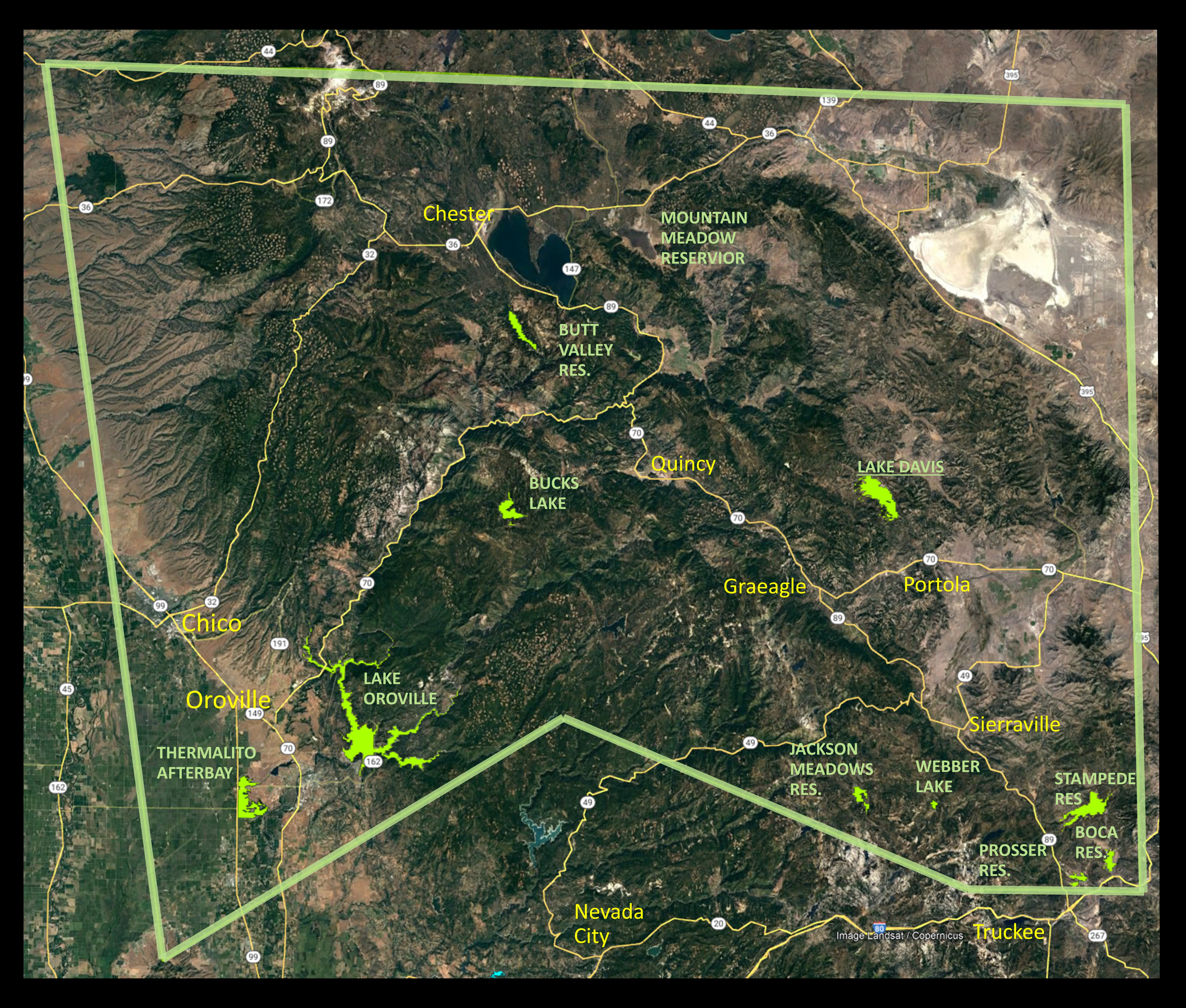
| Bucks Lake | C | 95M/ 2.8hr | 39°53’3.76″N 121°11’4.78″W | Beginner – Intermediate | Afternoon Winds | Maps Past Trip Notes | PIX1 | |
| Butt Valley Res. | C | 150M/ 2.9hr | 40° 8’17.37″N 121°10’24.66″W | Beginner – Intermediate | Afternoon Wind | Maps Past Trip Notes | ||
| Jackson Meadows Res. | C | 50M / 1.8hr | 39°29’37.31″N 120°32’53.01″W | Beginner – Intermediate | Afternoon Winds | Maps Past Trip Notes | *CA State Parks Reservations *Recreation.gov/ | PIX1 |
| Lakes Basin | D&C | 95 M / 2.2hr | 39°40’31.01″N 120°38’41.11″W | Beginner – Intermediate | Basin with many small lakes | Maps Past Trip Notes | https://www.recreation.gov/ | PIX1 |
| Lake Davis | C | 110M / 2.1hr | 39°54’58.30″N 120°30’36.29″W | Beginner – Intermediate | Afternoon Winds | Maps Past Trip Notes | *Recreation.gov/ | – |
| Mountain Meadow Res. | C | 150M / 2.9hr | 40°16’35.27″N 120°57’41.43″W | Beginner – Intermediate | Afternoon Wind | Maps Past Trip Notes | ||
| Webber Lake | D&C | 80 M / 2.2hr | 39°28’9.48″N 121°39’34.85″W | Beginner | Small Shallow Lake / Late Afternoon Winds | Maps Past Trip Notes | – | PIX1 |